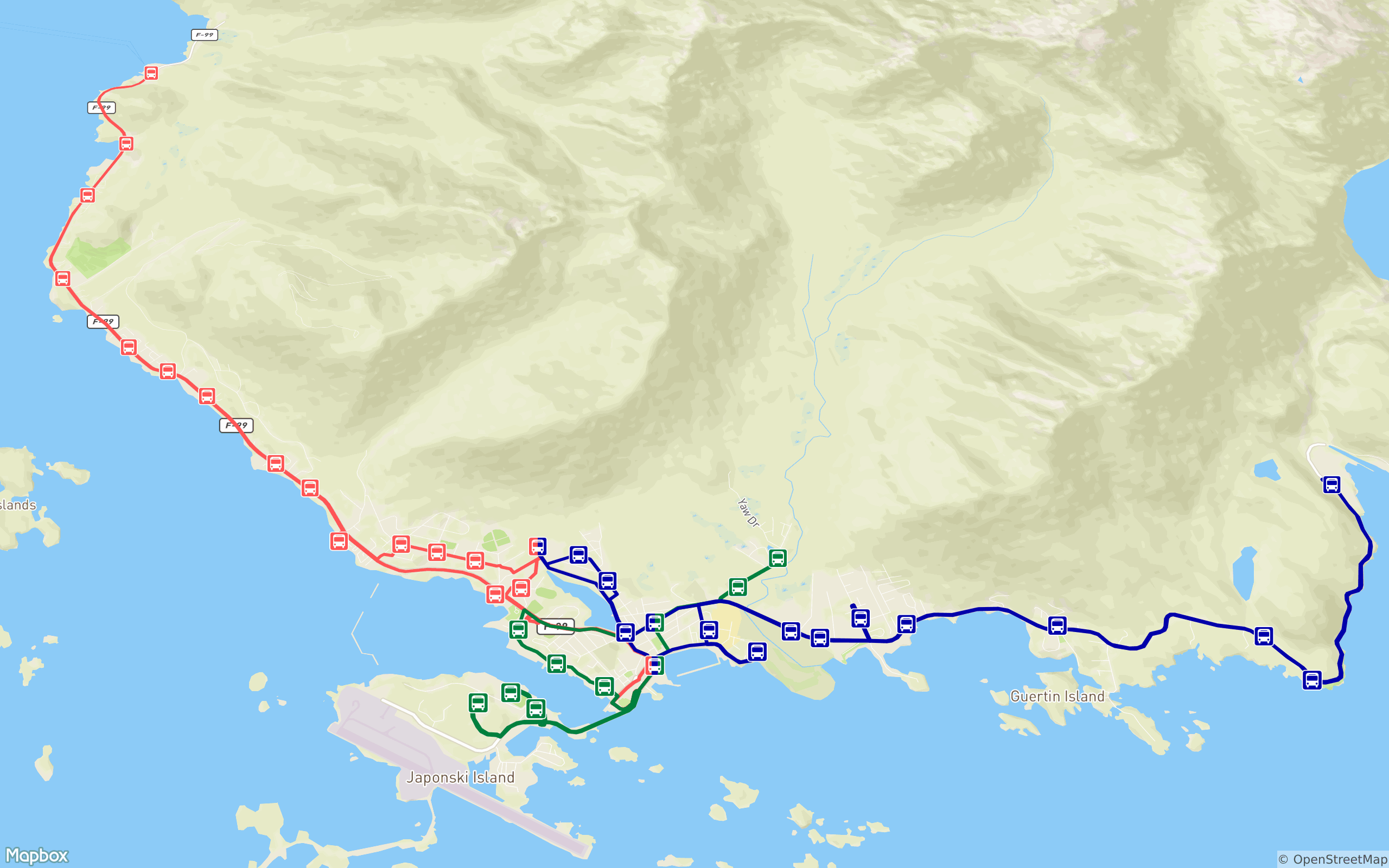
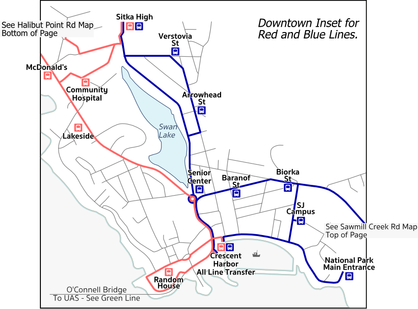
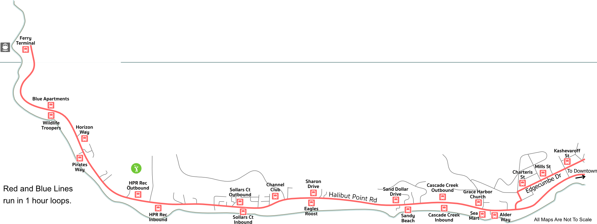
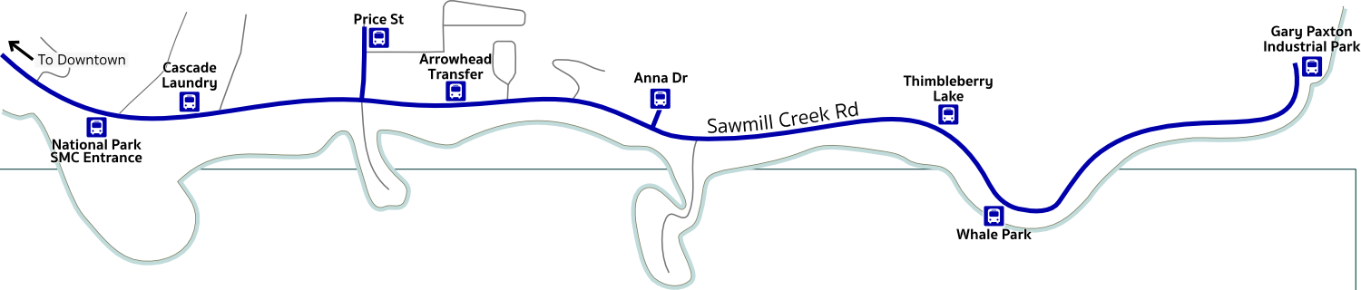
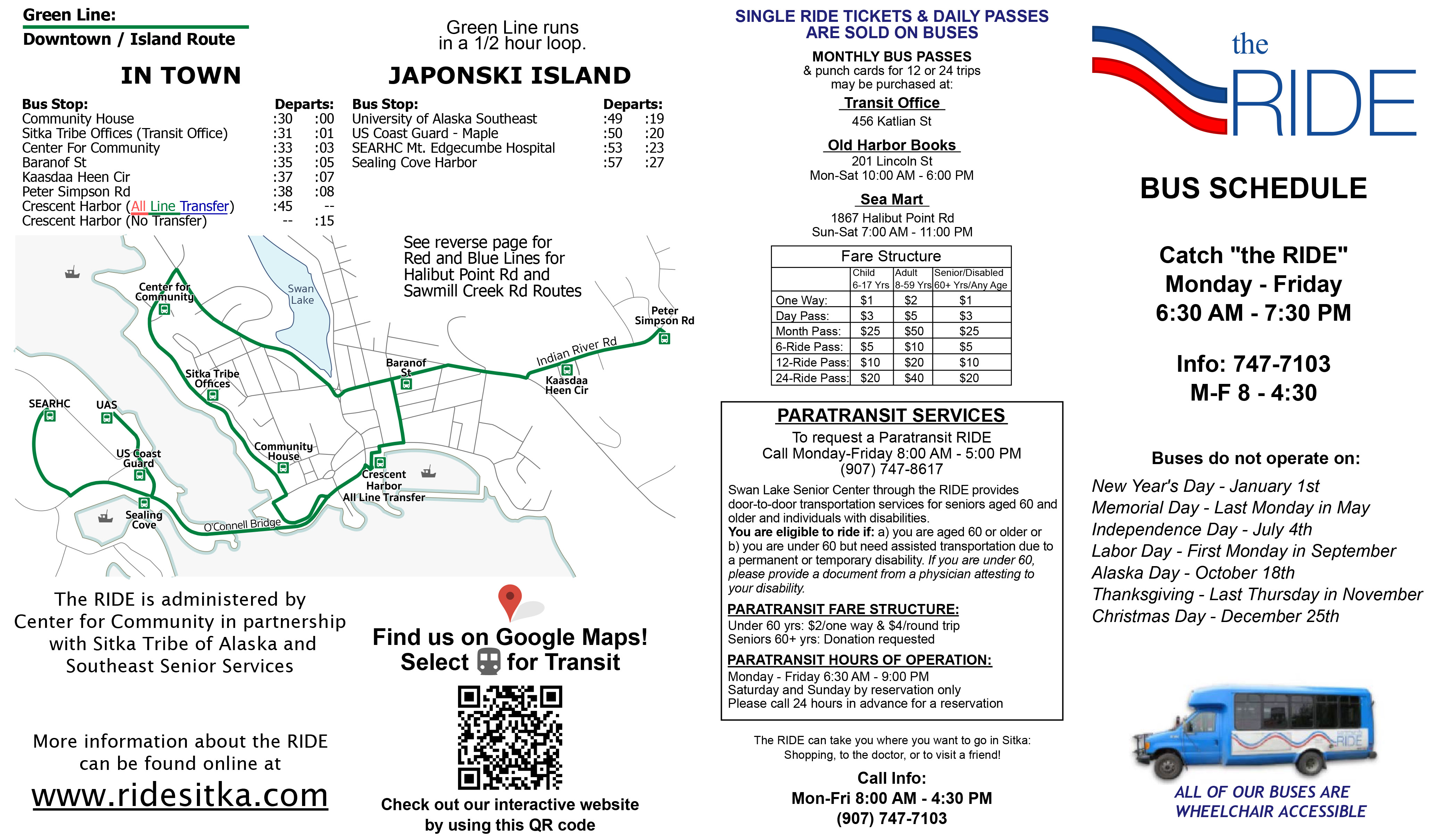
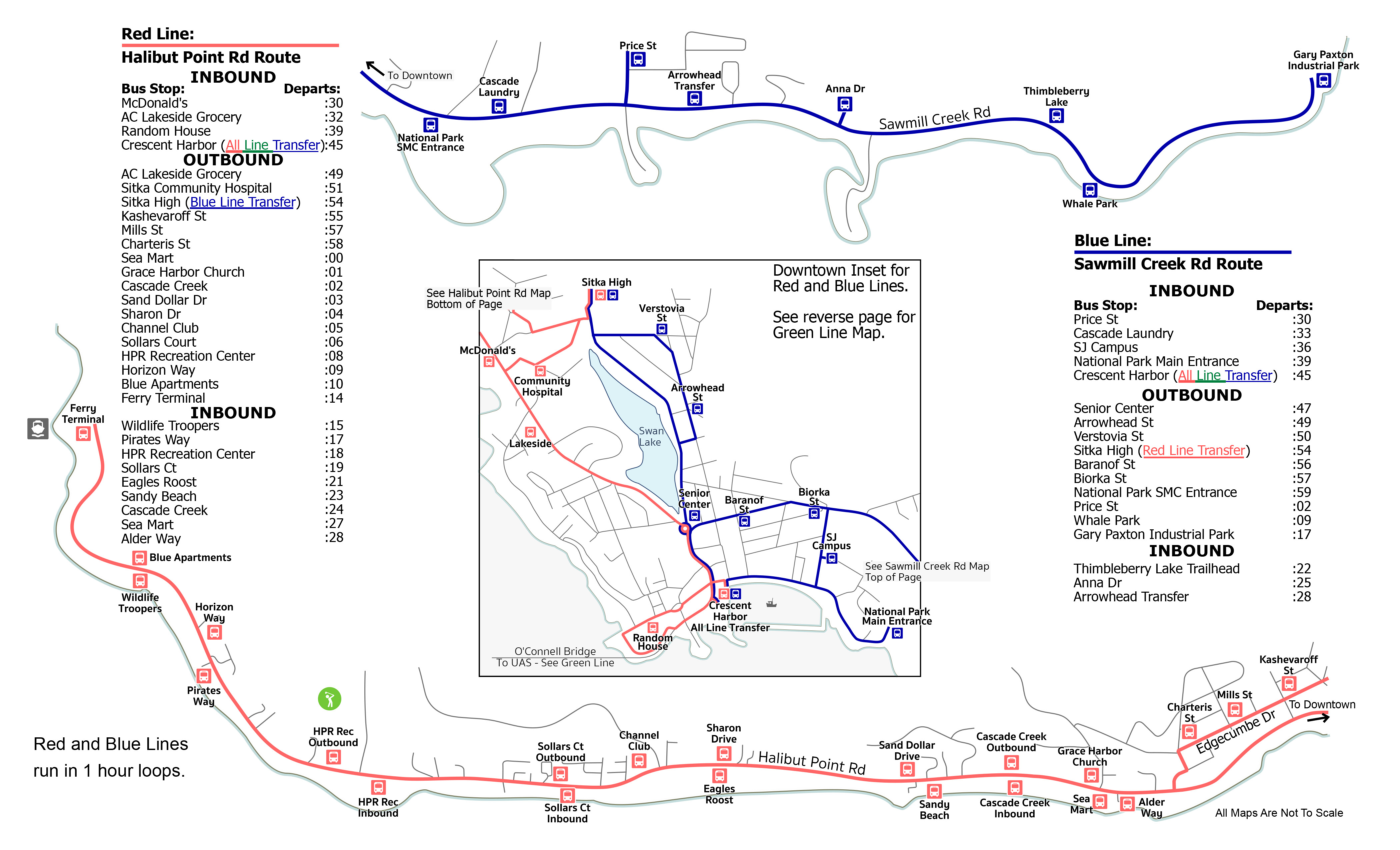
The RIDE runs three routes — Red Line (Halibut Point Road), Blue Line (Sawmill Creek Road), and Green Line (Japonski Island and Indian River). The map below shows the routes in relation to the map of Sitka.
 Click here for a printable version of the Ride schedule and map (PDF file, updated 2016 with Blue Line extension to Gary Paxton Industrial Park)
(maps and schedules from this document posted as images at bottom of page)
Click here for a mobile-friendly interactive schedule and map
(once link opens, click on the bus icons for schedule information;
also, click on the arrow in the upper left corner to show your location)
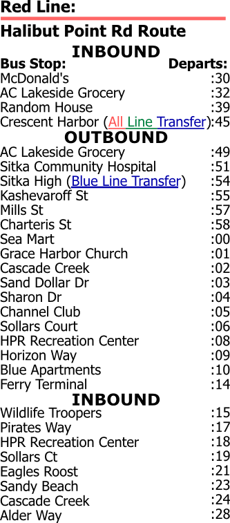
Red Line route out along Halibut Point Road – one-hour loop
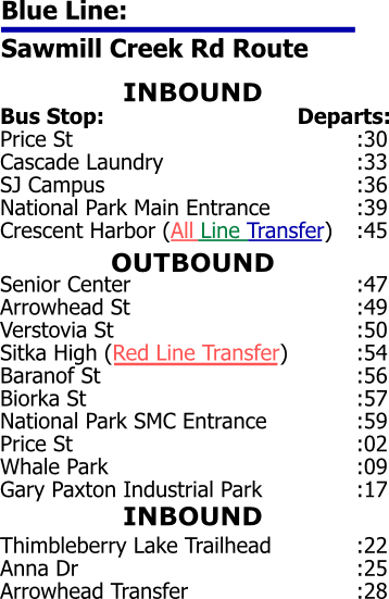
Blue Line route out along Sawmill Creek Road – one-hour loop (NOTE: the Blue Line was updated to extend all the way to Gary Paxton Industrial Park in 2016.)
Green Line route through town and over the O’Connell Bridge to Japonski Island – half-hour loop
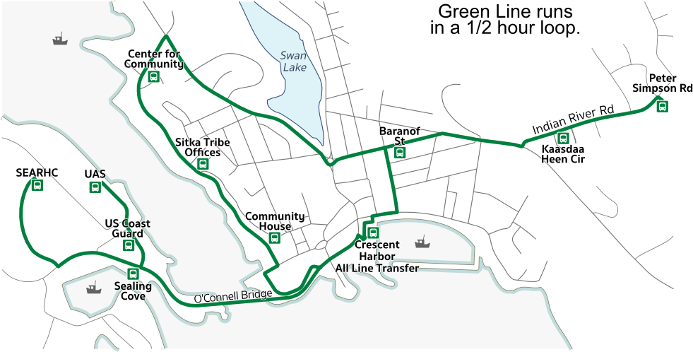
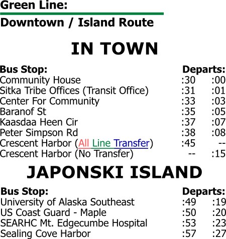
All routes leave Crescent Harbor parking lot downtown at 45 minutes past the hour. The Green route also leaves Crescent Harbor parking lot at 15 minutes past the hour.
2 thoughts on “Schedule and route maps”